AnimalsAn early start from Tebay so that the B and B owner could get back from dropping me off in Orton in time to feed his other guests. So this morning I was in Orton at 8 am, conscious that I might be on my own again due to the early start, and feeling a little anxious as today’s route is exposed and the forecast was poor. 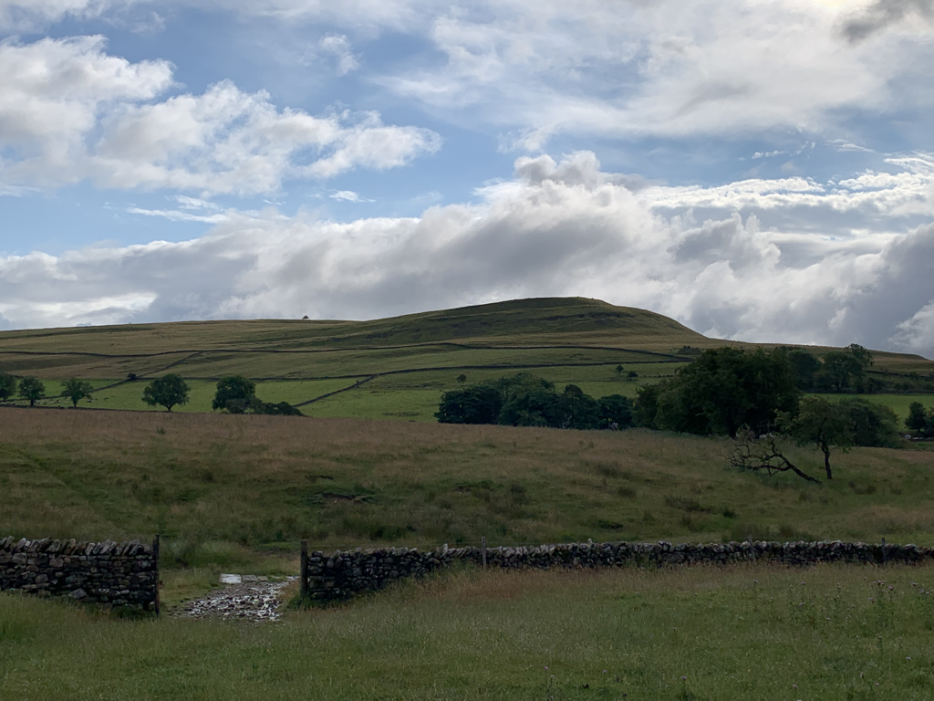 As I left the village a hare reared up in front of me, and rabbits scampered ahead. I felt like I was in a Disney cartoon. The sheep were hilariously noisy, shrieking at me with urgency to clear out of their field. There was no one else there to talk to, so I talked to them instead. They seemed unimpressed. 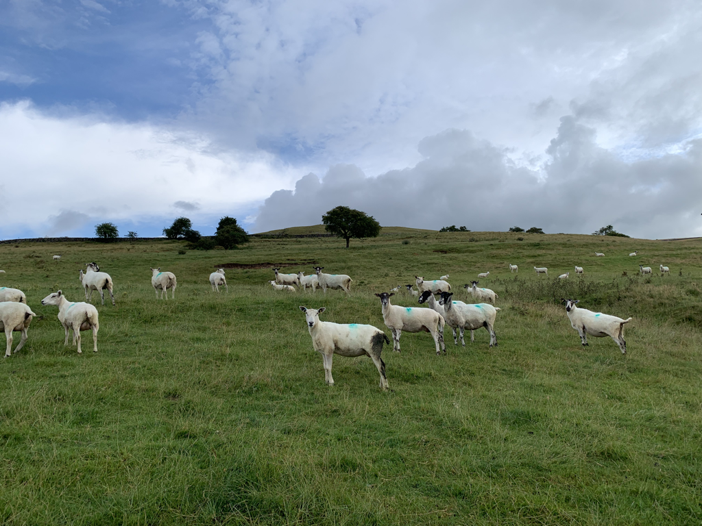 And then there were the cows. I don’t like cows much - I fear their unpredictability, and am not sure how to approach them. And they’re obviously very big. So generally I steer clear of a field with cows in, and take another route. But today that wasn’t an option. Over and over I encountered fields with cows and their calves. These are the most dangerous to approach, and walkers are regularly killed by being trampled, an average of 4 a year. I was glad I didn’t have our dog with me, but even without her I felt in danger. People have said that I’m brave to do this on my own - actually most of the time that there is any jeopardy I feel anything but brave. So cows were the theme of the day, I must have walked through 10 fields with them at least, and it’s tiring feeling on full alert whilst also trying to appear insouciant so as to not aggravate them. 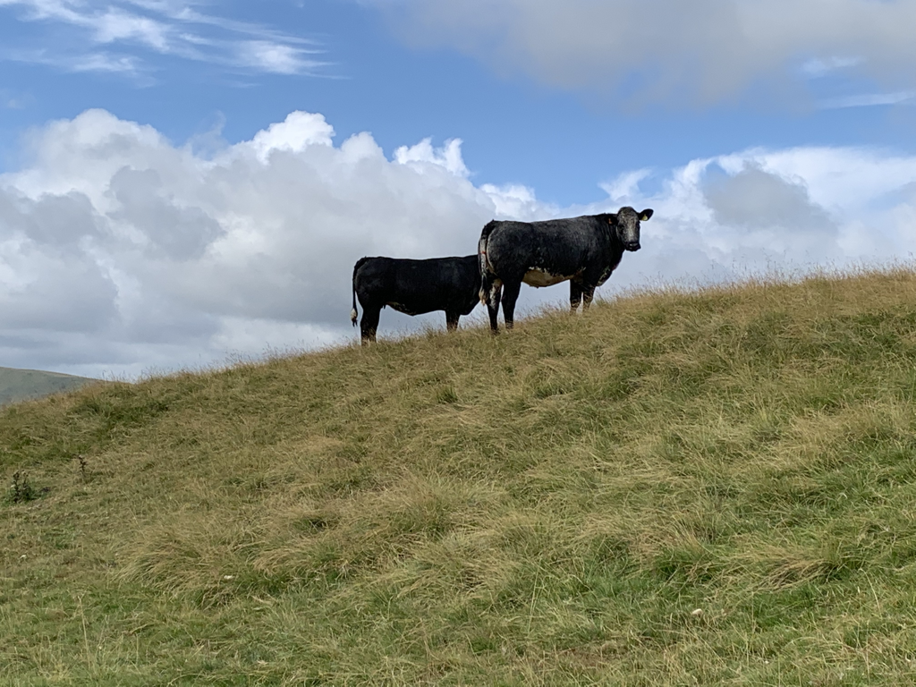 The forecast was poor for much of the day, but in the end I only had about 5 minutes of rain. It was wet underfoot though, after having hammered down in the night. Very different conditions to the previous days, with pools of standing water, some boggy patches, my legs getting wet from the soaked grass, and watching my feet so that I didn’t tread on the little frogs leaping in the moisture on the ground.  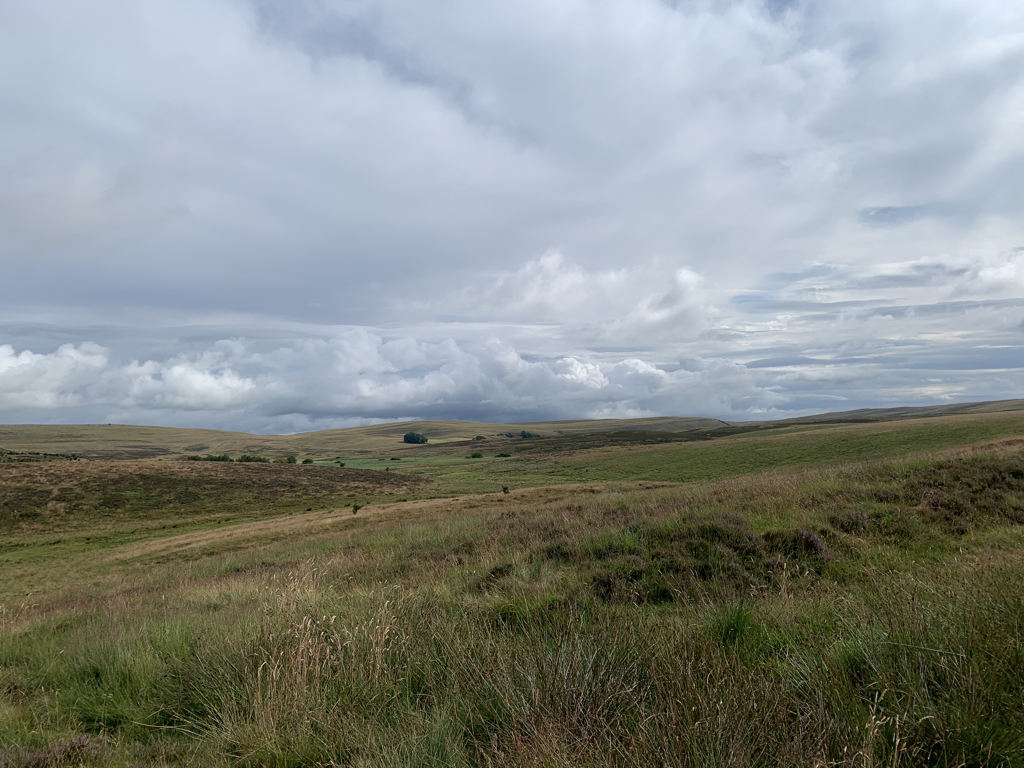 The path climbed past Orton Scar and Knott, and I passed a herd of wild ponies before turning out out onto Ravenstonedale Moor and then to Crosby Garrett Fell (maybe the band Crosby was in before he joined Stills and Nash? - sorry, desperate nerdy mum joke) This is more ancient land. Up on the top, it felt miles from anywhere, and I would be moved by the feeling of isolation and remoteness, only for the little road to pop up to tell me to get over myself with my Wuthering Heights ideas - I was not as far away from civilisation as I thought. 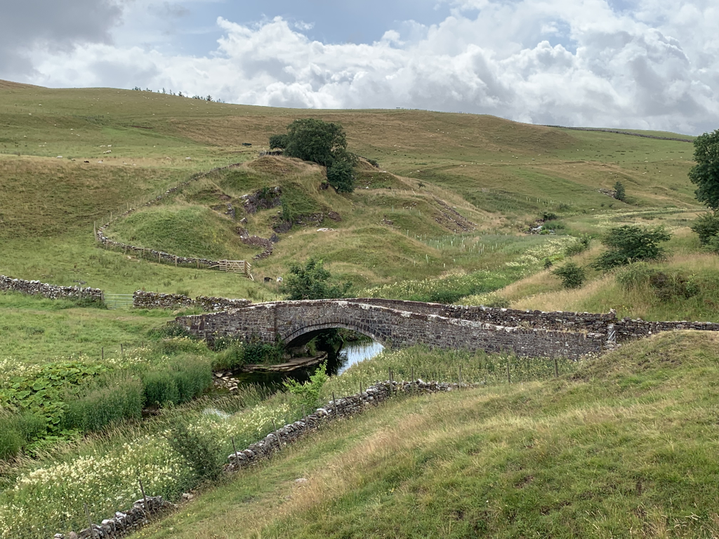 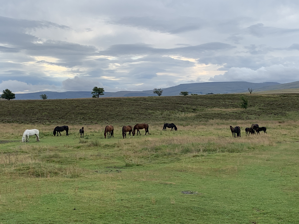 The path skirts Severals Settlement. This is the remains of a complex of prehistoric British villages, and is listed as an archaeological site of key importance. From the walker’s perspective it is frankly underwhelming, looking like a series of undulations and banks. It seems it’s much more easily appreciated from a hang glider. That is a challenge too far. As the track proceeded to Smardale Bridge I bumped into Wendy and Liz, two of the dog walking women from yesterday. I could see first hand just how difficult it is to walk dogs round here - one of the dogs had made a run at the stile to try to jump over it and had hurt her chest, frightening her so much that she refused to go near another one. An extra stress for everyone concerned on top of a long day’s walking. Happily, later I met them all again and joined them for tea and cake, Chewy (the dog, not the cake) seemed OK, hopefully she’ll have forgotten the trauma by tomorrow’s walk. We hope to all meet up again to give ourselves moral support on the challenging leg tomorrow. 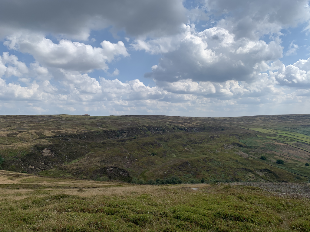 The highest point of today’s walk came quite late on, at the top of Smardale Fell. Then it was a bit of a trudge through lots of cow fields into Kirkby Stephen, so I got Bill on board again. Today’s fun fact is that you pronounce endorphins with the emphasis on the first syllable. Or at least that’s how Mr Bryson does it. He was also discussing appetite, but didn’t consider the strange appetite phenomenon that I’m experiencing. During the day, both before and during walking I am having to force myself to eat because I know I must keep myself nourished. This is partly why I’m recording the calories burnt on the walk - so that I can see how many must be ingested to keep going. Presumably exercise is an appetite suppressant. I try to make up for it in the evening….  Into Kirkby Stephen, the biggest place I’ve seen since Whitehaven a week ago. A flourishing market town, and a fantastic B and B in the Old Croft House - the best room so far by a country mile. Whilst waiting to check in I chatted to Lindsay and Paul who were sheltering from the rain with me in a neighbouring pub. I think Lindsay is going to plan a solo walk after my evangelising….  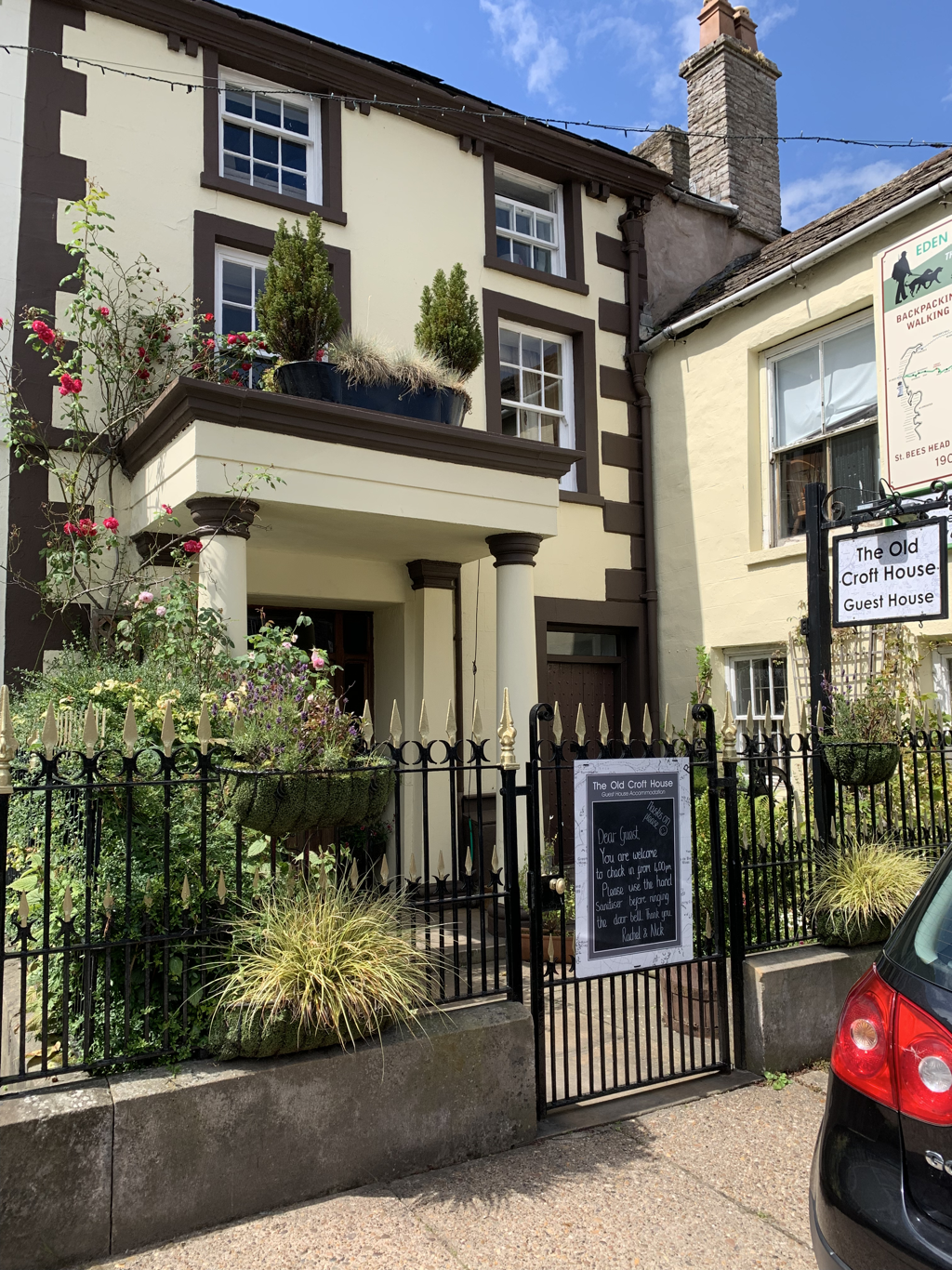 Stats
Distance: 13 miles Ascent: 696 feet Calories burned: 1815 Today’s ear worm: Jessie J - Price tag (no idea….) Number of times I took a wrong turning in the first mile of the walk due to not sleeping well (that’s my excuse): 4 Hearty post walk dinner and local tipple : Chicken tikka biryani and entirely not local Cobra beer Video of the day: https://www.relive.cc/view/vJOK2X5kdwv
3 Comments
An easy start across undulating fields - there is some ascent today but far less than the last few days. And although it’s 13 or so miles, the lack of ascent meant I risked wearing my walking shoes instead of boots, to give my feet a change. The narrowing of priorities to footwear, calories and weather is liberating and intriguing. An hour or so through fields full of animals to get to Shap Abbey. 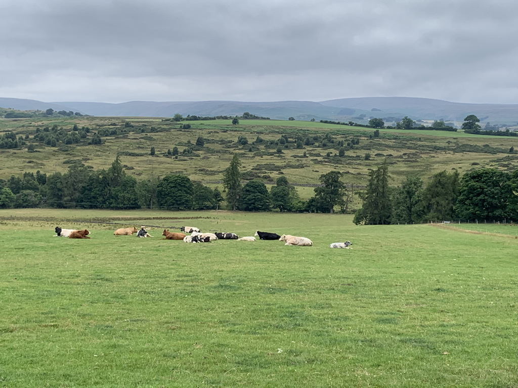 Although the Abbey’s stone was mainly removed after the dissolution for buildings in the area, the tower still remains. I had a bit of an Ozymandias moment, which often happens when I see ruins of something that had been built as grand : My name is Ozymandias, King of Kings; Look on my Works, ye Mighty, and despair! Nothing beside remains. Round the decay Of that colossal Wreck, boundless and bare The lone and level sands stretch far away.” Thanks to Percy Bysshe, and A level English set works for giving me decades of feeling depressed at the sight of these sorts of ruins. 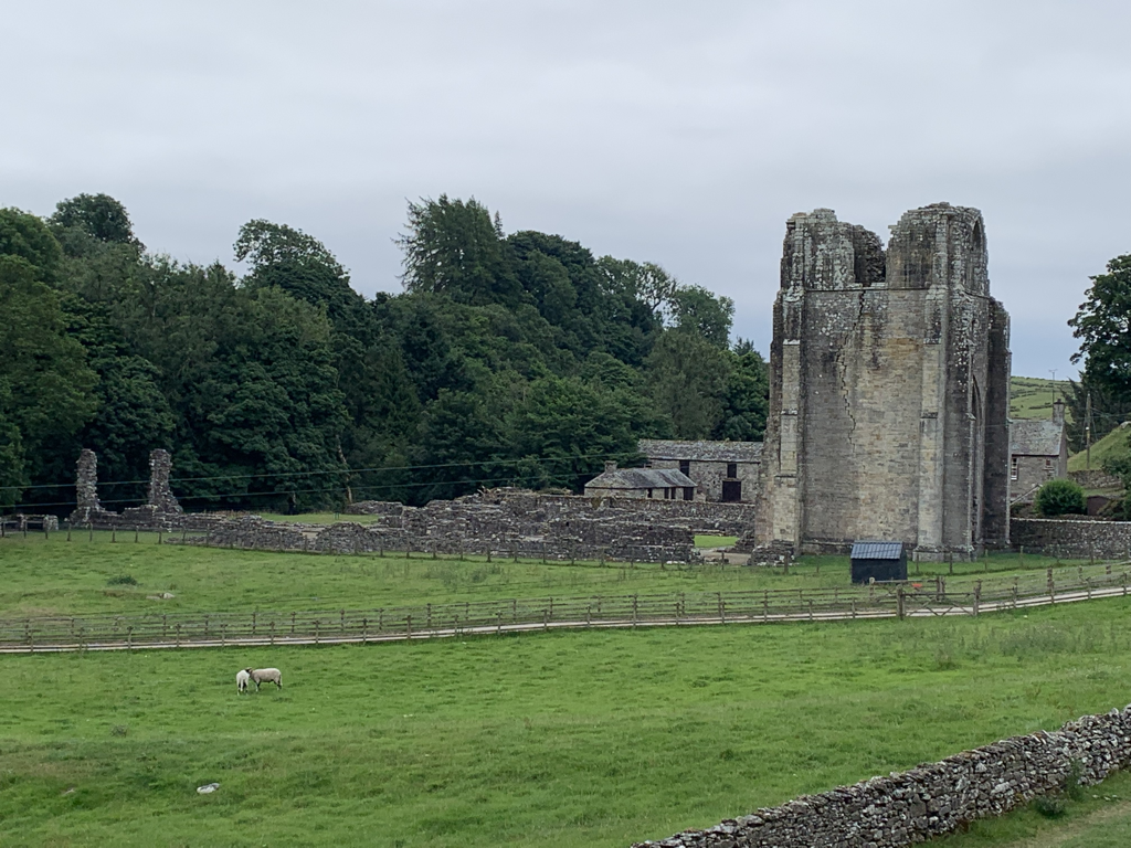 Climbing away from the abbey, I could see both the M6 and a mainline train at the same time. It felt like a reminder of another existence, where there are people who aren’t just focused on boots, blisters and maps. My world has got both bigger and a lot smaller. An excitement now is noticing that pelargoniums are the new wildflowers in the verge. 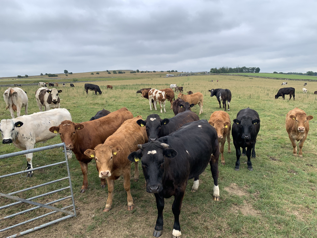 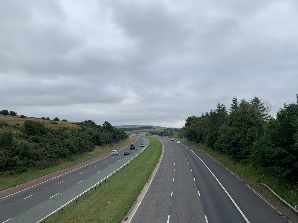 As the motorway noise fell away, the landscape rose, and after passing a quarry I caught up with other walkers. 3 uncommunicative men, either to others or between themselves, a young couple following the same Cicerone guidebook as me, 3 women of my age with a dog each who are doing the path in stages. Their dogs are large, and the stiles so far are exceedingly unwelcoming to dogs. Maybe because it’s sheep country. Anyway, it means that at every stile they have to lift their dogs over. One said ruefully that it was a different sort of workout to what they’d expected. 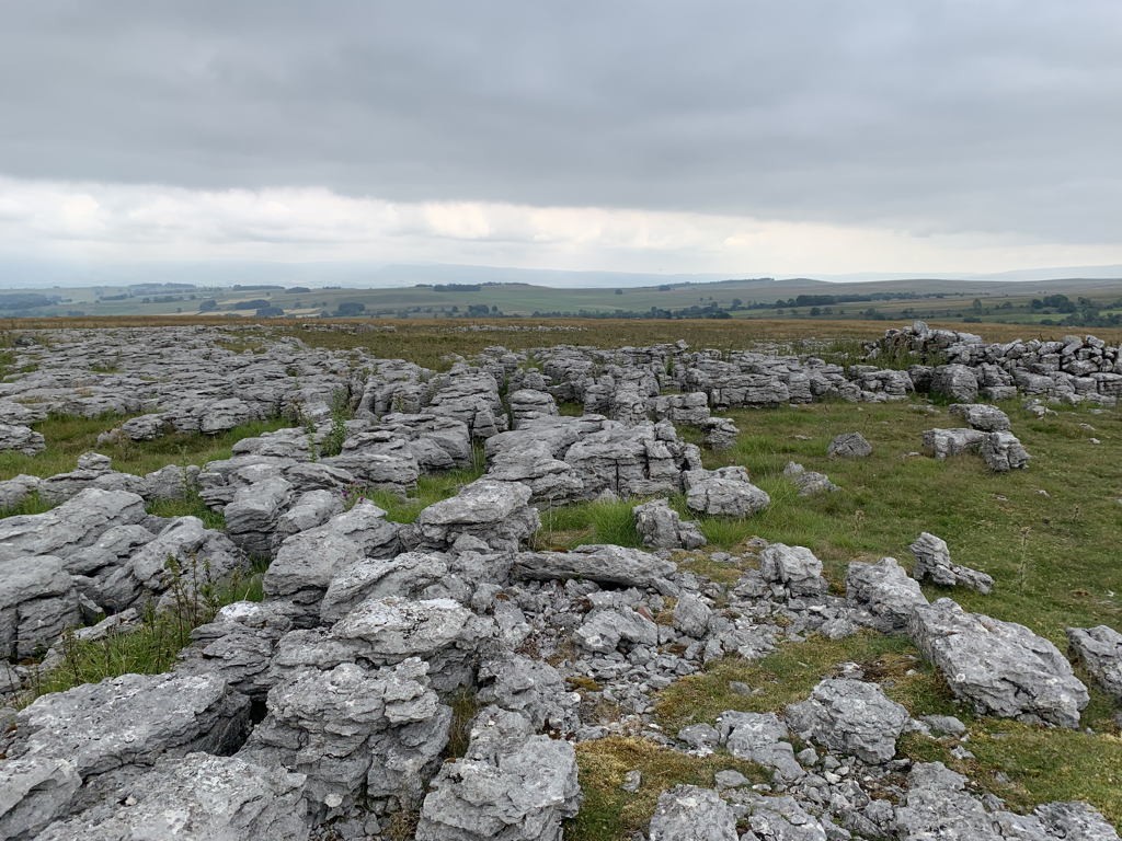 Having reached 1000 feet, or thereabouts, there was a fairly even plain of limestone moor, the Crosby Ravensworth Fell, part of the Yorkshire Dales National Park. This is ancient land. Prehistoric communities, Bronze Age, the Romans, they’ve all been here. The sense of space and easy walking underfoot was exhilarating. Stone circles, odd ‘erratic boulders’, heather about to burst, the sound of nesting birds that I wished I could identify - it was a memorable couple of hours walk. The guide books and the maps described Robin Hood’s Grave being in this area - featuring an ancient cairn. There are a lot of cairns and piles of stone, and by the time I’d realised I probably had missed the special one I was half a mile away. Every footstep counts, I wasn’t going back to check on an old cairn under which Robin Hood was probably not buried. 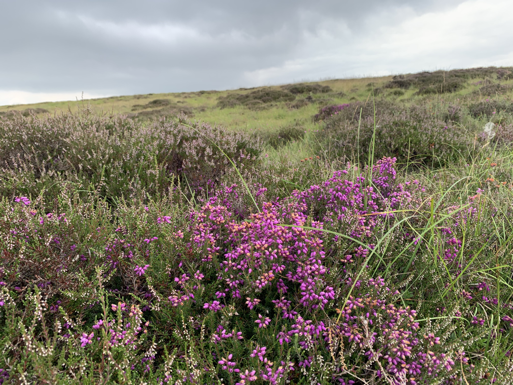 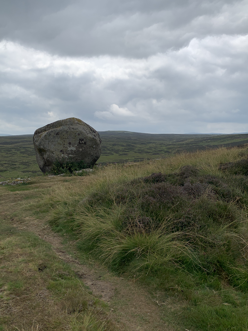 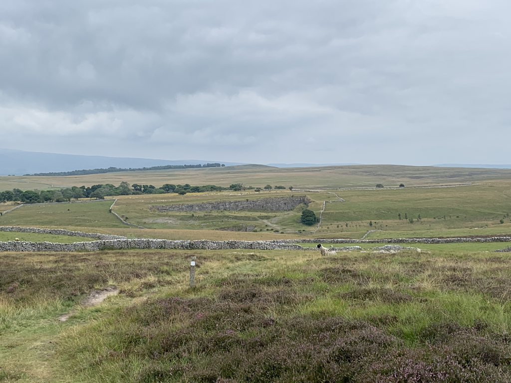 Reluctantly leaving the fell behind, I followed the road and the footpath down to Orton. This is not a big place, but it was significant in that it was the end of today’s walk, and also the home of Kennedy’s chocolate shop, about which I had heard much from friends who had been here before. Whilst drinking hot chocolate outside, waiting for my lift to tonight’s lodging (a little way off the trail in Tebay) I chatted to the couple with the Cicerone guidebook, Ben and Georgia. Ben is also a music teacher. Is there something about the path that draws us? And to add to the weird coincidence, they both teach in a school in Marlow, down the road from us, and Georgia grew up in Seer Green, our village. 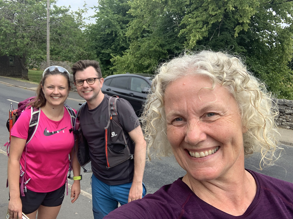 The final leg was with the owner of the B and B in his car with his foster son. He told me that he was 7, and then asked if I was 91. The path is clearly taking its toll. Stats
Distance: 13.8 miles Ascent: 1132 feet Calories burned: 2280 Number of fields I walked through with cows and calves even though they were looking at me funny: 3 Number of fields that I decided the cows were looking at me too funny and therefore I’d take a detour: 1 Hearty post walk meal and local tipple - chicken and mushroom pie with mash, peas and gravy and a Wainwright’s Golden beer at the junction 38 truckers’ services…., Fantastic, and the best value meal f the trip so far. Video of the day: https://www.relive.cc/view/vAOZzBxeMyO KidstyA lovely encounter at breakfast this morning with Courtney, a young Aussie, who now lives in London, who’s also doing the path. She’s tougher than me, and is mainly camping, but had wisely decided to discard her big pack in favour of a transportation service. To our mutual delight we discovered we are both music teachers. This led to an animated discussion of the joys of our jobs. For the others in the breakfast room, if you weren’t interested in how rewarding it is to get people singing, sorry! 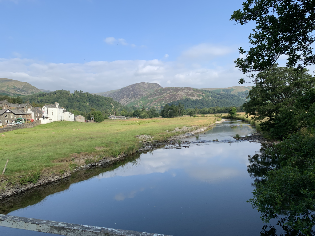 The lovely landlady last night had reassured me about today, which is thought to be one of the hardest of the trail. She said that I’d find it very doable, and that was hugely helpful before setting off. She did say that the first half an hour was a stiff warmup, and she wasn’t wrong. Steep climbing for a mile and a half, and then some respite with some flatter sections for the next little way till Angle Tarn. I took it very steady, stopping every 15 minutes or so. In another life I would have seen the challenge to be to get to the top without stopping. Now it’s much more about listening to what my body is telling me, and giving myself a break if I need it. And in doing that I’m noticing more and punishing myself less. So had I not stopped for a tea looking over the tarn, I wouldn’t have seen the two supersonic RAF jets hurtling down the valley. 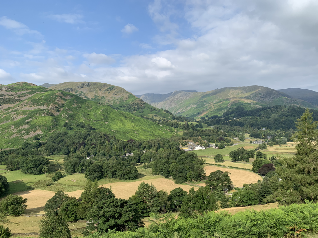 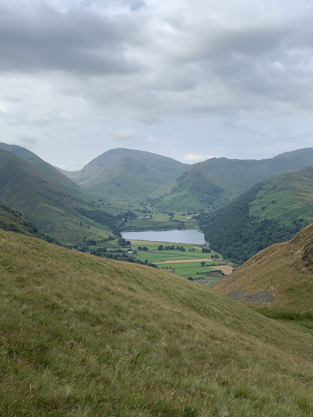 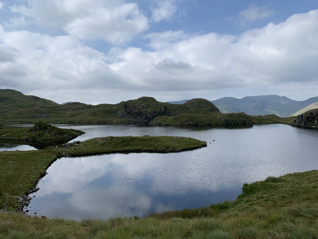 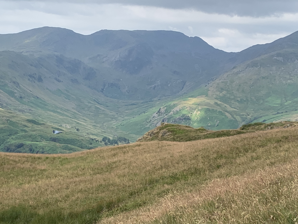 The climb continued, relentless but rewarding with the changing views. I passed the spot that Wainwright described as the 50 mile marker - that feels like an achievement in itself. And I was beginning to get glimpses of flatter landscape beyond the edge of the Lakes, where I’m heading. 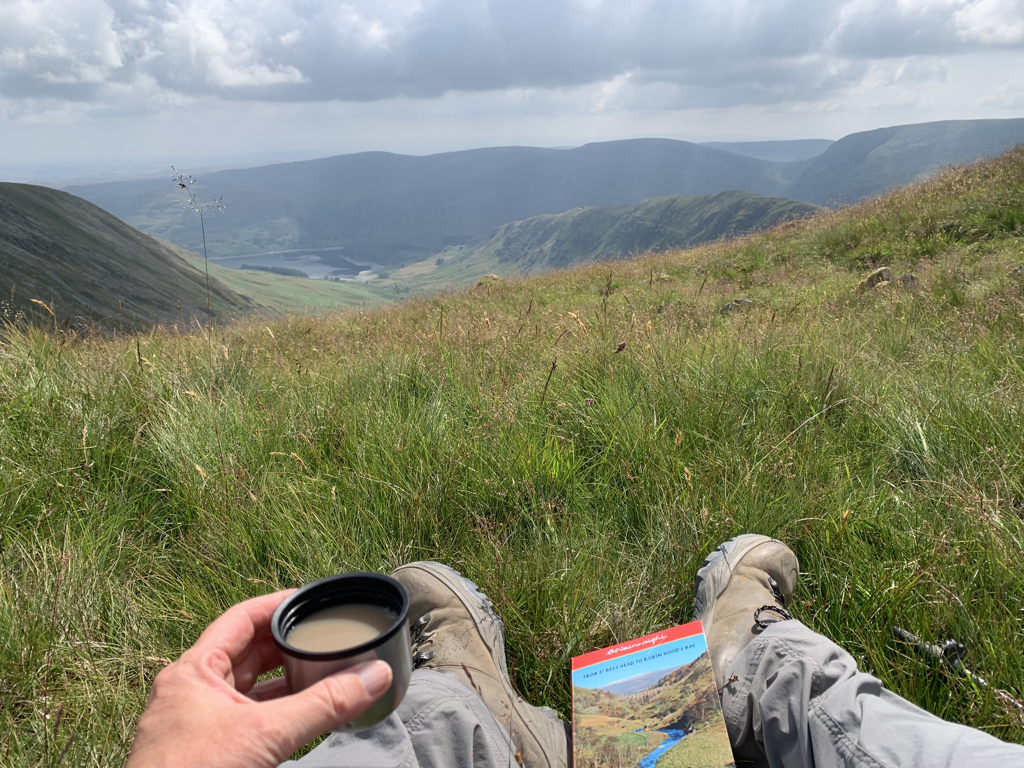 After 5 miles of relentless uphill, in the end it was an easy stroll along the path skirting the rim of Riggindale to reach Kidsty Pike. On the way I could see High Street, an old Roman road, used by the centurions across the top of the fells. They must have been fit. This is the highest point of the path, and signifies the beginning of the end of the Lakes. I felt elated that I’d managed the stiff climb, and a little nostalgic to leave the lakes behind. I was glad I’d brought AW along to point out which peak was which. 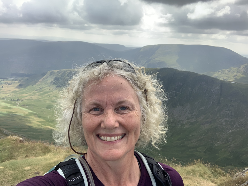 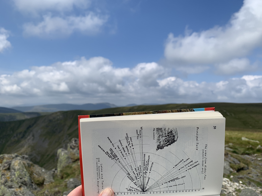 But the elation turned to deep sadness as David rang to tell me an old and very dear friend had died. Farewell Paul, you and I helped each other through the joys and horrors of our teacher training, and those parties were unforgettable. A sweet, kind and engaging man, younger than me, I will miss you. All the regret for not keeping up as often as we should, and the grief that he only had a year post retirement. Carpe diem. 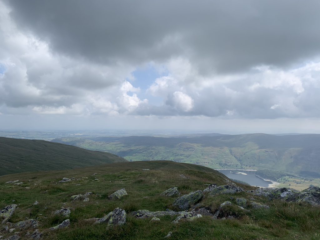 Through quiet reminiscence and periodic tears I made my way off the Pike and down towards the lowlands. Last night at the hotel I watched a clip of Kate Humble doing this part of the walk. She descended over the boulders like a mountain goat. That’s not the animal I would describe as the one to embody me. Unless goats go down hills mainly in their bottoms. 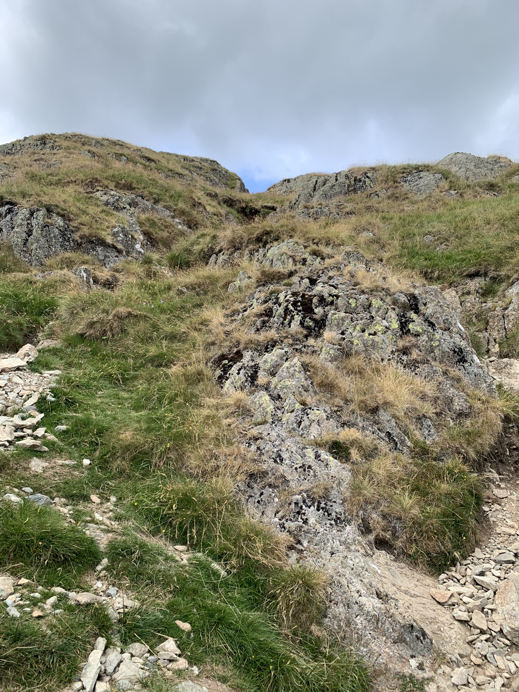 Eventually the path flattened at the head of Haweswater - a lake that was turned into a reservoir to the cost of the village and farm nearby - the farm ruins are still obvious, and I’m told that the village ruins can be seen if the reservoir levels are low. Then there was a surprisingly steep pull up into the forest above the water, and when gasping for breath on a large granite shelf I was delighted to be joined again by Courtney. We walked together for an hour or two, and the miles went by much more quickly in her company. As we said goodbye, with her walking on further than me, I sat to recharge both my tech and my calories. Across the path I watched two red squirrels running up and down the tree - the first I’ve seen for decades.. 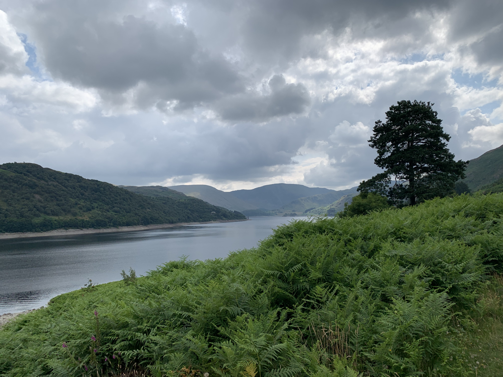 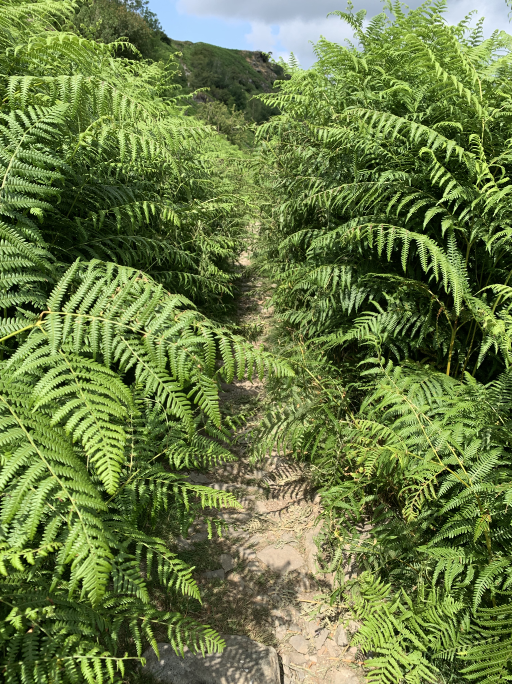 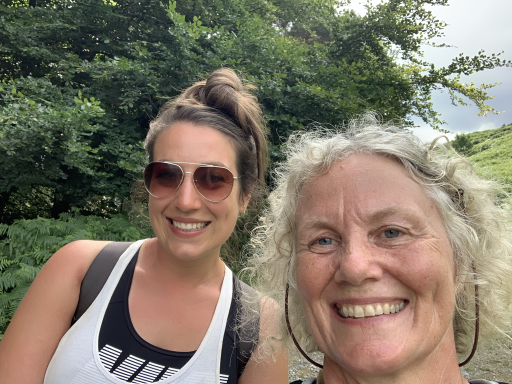 The final leg was an extraordinary difference to all the walking so far. Gone was the rugged and unforgiving nature of the Lakes, instead it was the much more gentle landscape of the beginning of the Eden valley. It feels much more like home. 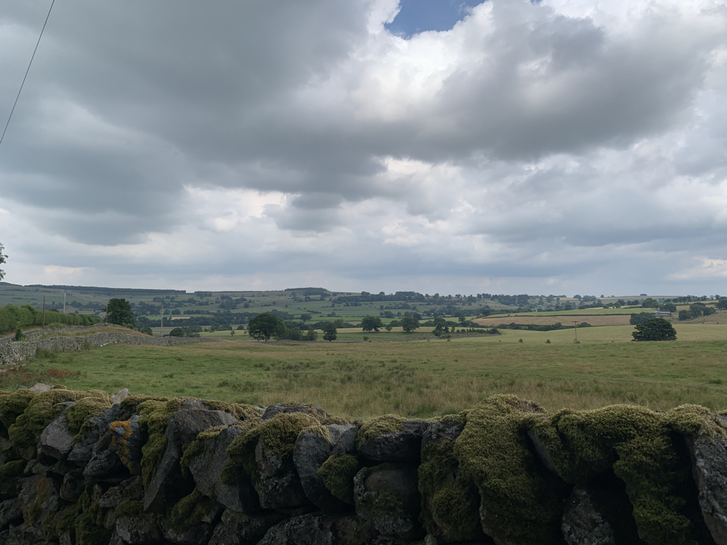 And the day finished with a fantastic meal at the Crown and Mitre in Bampton Grange in the lovely company of Karen and Steve, who are walking the path too. It’s good to know that there’ll be friendly faces popping up whilst walking over the next days.  Stats
Distanced covered: 12.5 miles Total ascent: 2484 feet Calories burned: 2400 Number of items I thought I’d left in the hotel room and therefore would have to get posted: 3 Number of items I’d actually left in the hotel room: 0 Hearty post walk meal and local tipple: Fish pie and sticky toffee pudding with Ullswater Ales Boathouse blonde Video of the day (technical hitch for the first two hours!) https://www.relive.cc/view/vE6Jp2wnPxv PeopleI had a restless night, feeling discombobulated, missing David. Although the Glenthorne was very peaceful, everyone there was very much focused on their own group, and it had accentuated how difficult I was finding being away from my tribe. Having no one else (as far as I can see) doing the walk at the same time as me has meant that there hasn’t been the sense of camaraderie that I had expected and hoped for. But the morning was beautiful and talking to David on the phone as I set off settled me for the day ahead. This is a short day in terms of miles - only 8 or 9, but a number of people have said it’s a tough one, and certainly the incline would suggest it, so I was expecting to take it steady. Until a couple of days ago it had been forecast to rain today, but instead it was perfect weather for walking, not too hot and clear skies.  The profile of the walk was entirely up and down, and the climb started pretty soon after setting off. I walked away from Grasmere, past Tonguegill Force, and then started walking up the valley with Great Tongue on one side and Rowan’s Ground on the other. Just last night I’d been learning about a farmer at Great Tongue and his high quality Herdwick - I said hello to a few on the way. The valley is covered in ferns, extravagantly lush and green, almost arrogant in their vigour. 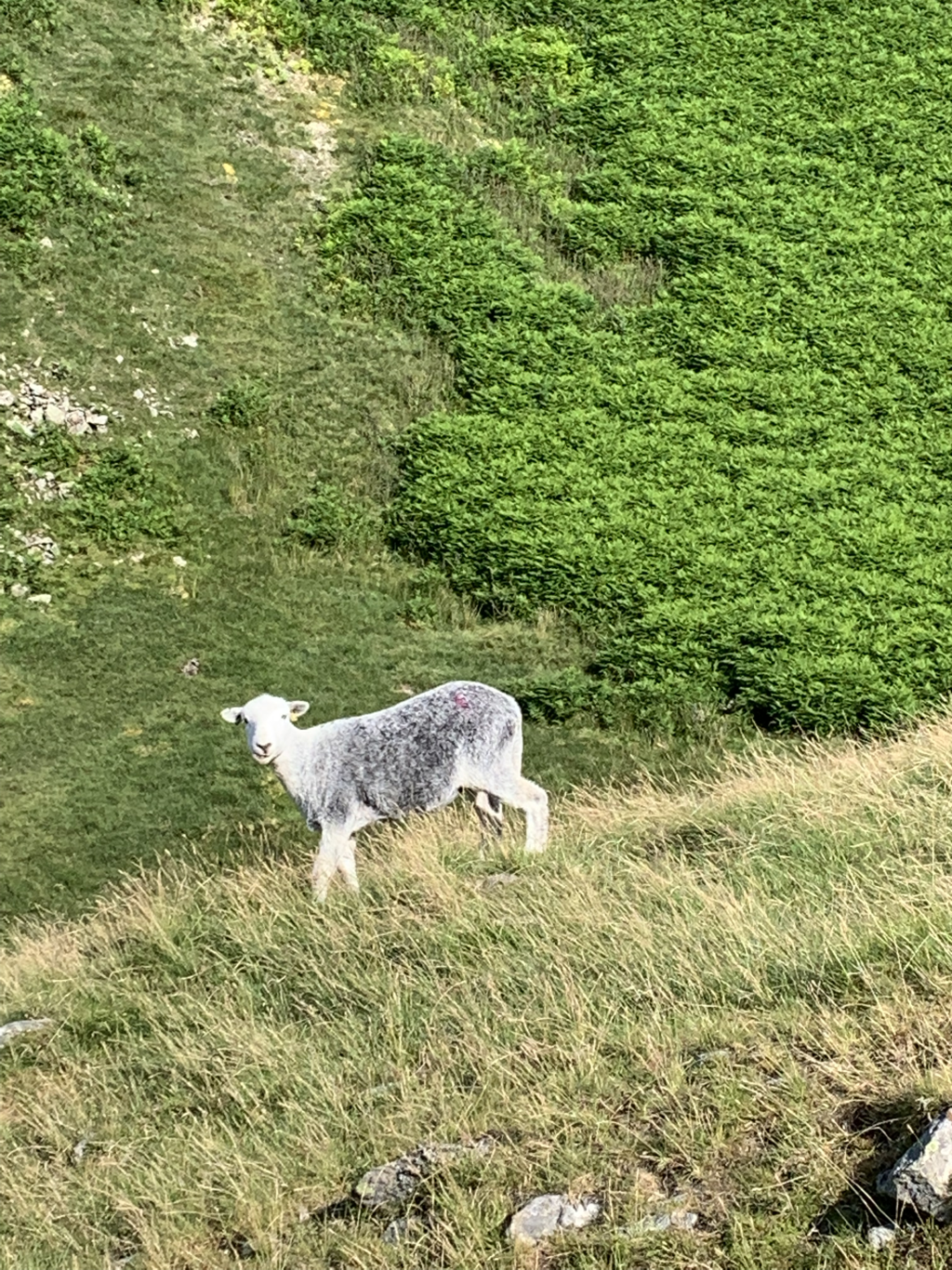 The path was clear and unequivocal, though a stiff pull. Nearing the top of the first section I stopped for a cup of tea from my ruggedly dented thermos. Again, like yesterday, the morning’s anxieties receded in the loveliness of the landscape. An intrepid mountain biker passed me going the other way. Now that would really give me anxiety. Within moments he was off his bike and repairing a major puncture. I’d rather have blisters. 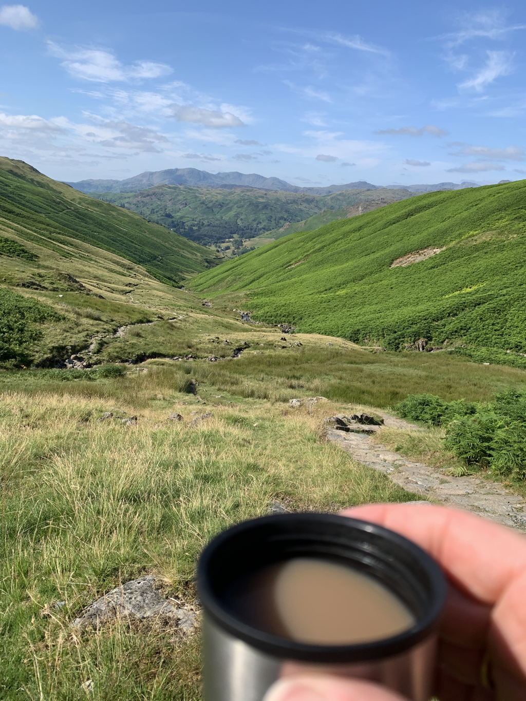 The path continued clearly up the valley, intersected at one point by a presumably ancient fall of huge granite boulders. No really scary stuff to negotiate here - giving me the chance instead to be impressed at their size, and imagine how it would have looked to see them when they were on the move. 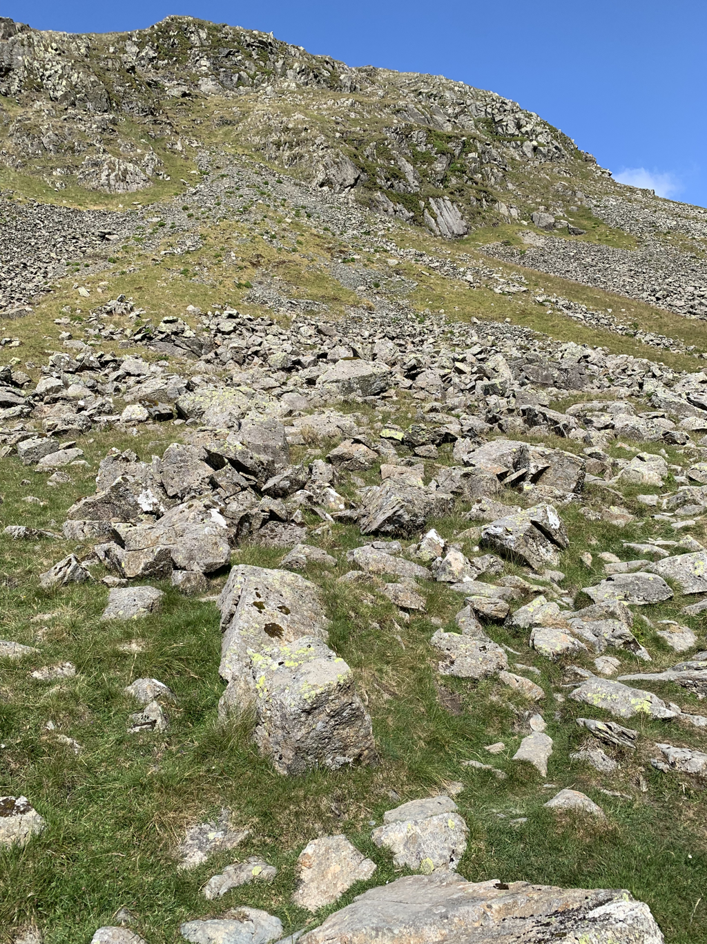 A tantalisingly brief call from a dear friend in a moment of phone signal was really welcome, but as soon as the signal came, it went, leaving me feeling a bit more alone than I had before. But I was then at the top of the ridge, and before me was Grisedale Tarn. I gasped out loud in surprise, even though I knew it was coming - there is something magical about these tarns up at 2000 feet, implacable and still, surrounded by a giant bowl of green. Legend says that Dunmail, King of Strathclyde, ceremonially threw his crown into the tarn before becoming a pilgrim. It certainly feels like a place of historic drama. 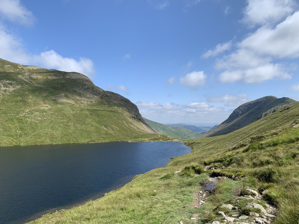 And for the first time on my C2C there really were people. Walkers on the opposite fell, walkers climbing up towards Helvellyn, walkers climbing down towards the tarn. There were three young men breaking camp opposite the water. As they were hoisting their packs one noticed that the second had thrown tissue on the ground. He asked him to pick it up, this resulted in a fervent row about the biodegradable nature of tissues and whose responsibility it was to pick it up. The natural amphitheatre round the tarn meant that even half a mile away the row was audible. They walked off furiously, and then: I don’t like this silence man. What silence bro? Your silence bruv. And they started to argue again , this time about who was carrying the most, with the third youth exhorting them to appreciate the view and stop and stare for a second. I observed and listened from my vantage point on a rock at the head of the tarn, fish swimming round at my feet. I picked up all my rubbish when I left, biodegradable or not. Another two men, middle aged this time, were commenting from some distance away on the great place that man has chosen for his lunch. As they got nearer to me, one said ‘oh, actually it’s a lady’. There’s nothing ladylike about the state of my feet. 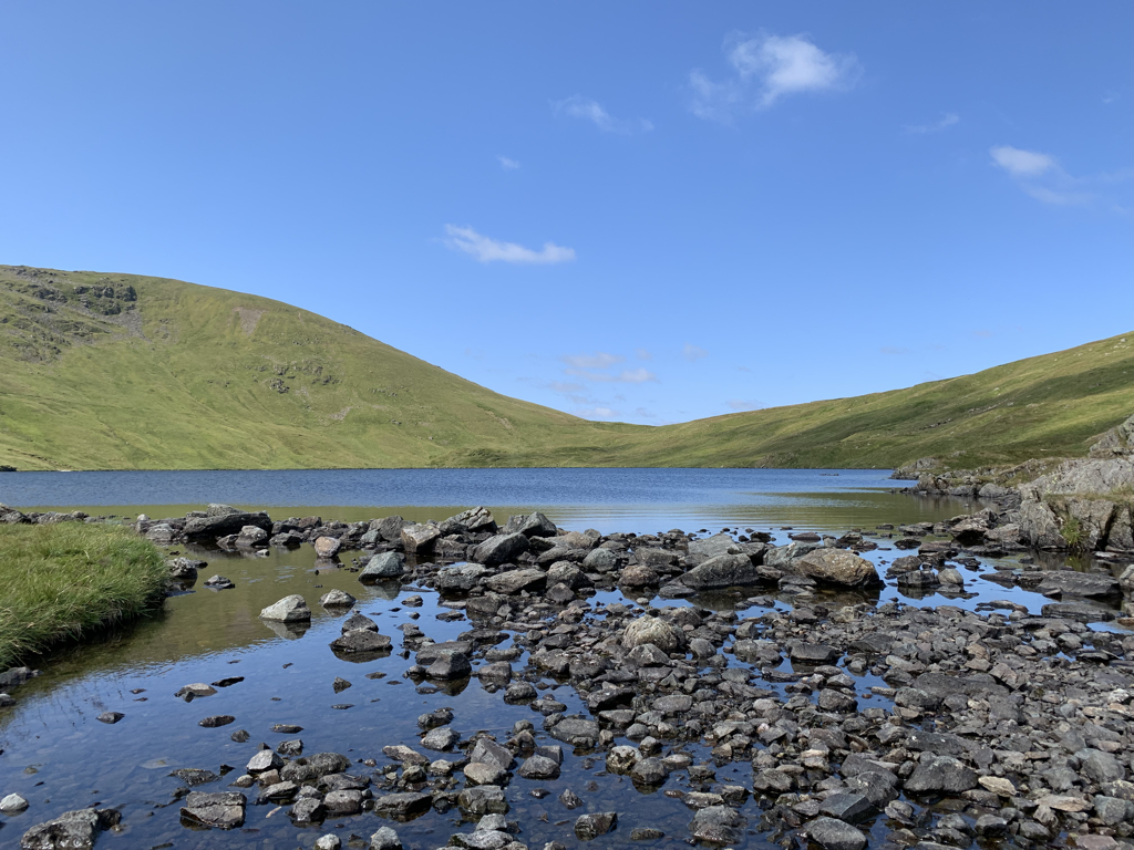 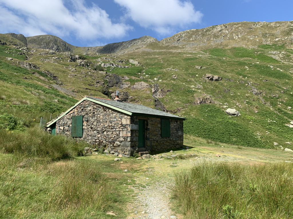 And then starting the descent down a rough and boulder strewn path, I passed another young man sitting disconsolately by his enormous bike. He was anticipating the last push up the hill with some concern. He explained to me the tubeless system for his tyres, and then said ‘I chose an e bike because I thought it would help me up the hills. Instead I’ve just got something heavier to push’. Further into the descent, passing the isolated mountain hut, I resorted again to Bill for company. He was addressing the olfactory system today, just as I noticed first the sharp smell of sheep dung and then the evocative scent of pine as I neared the bottom of the slope. Our sense of smell is better than some think, it seems. Many people can identify their spouse’s T shirt out of a set of 15. I would hope David won’t have to go too near my current T shirt till it’s been in the wash. I can certainly identify it with no problem. He also discussed losing the sense of smell, which seemed prescient now, with so many affected with post Covid anosmia. A lovely welcome at the Old Water View in Patterdale, where Wainwright himself once stayed. There can’t be many hotels where it’s suggested that you dip your feet in the river whilst having your drink, and there is an honesty bar with local gin and beer. The drink by the tarn was made all the better with the company of Deborah and Peter. They were sitting enjoying a quiet moment together when I arrived, sweaty and excitable, to disturb their peace at the next table. They couldn’t have been lovelier with their interest in the walk, my navigational aids and lack of sense of direction. Their friendliness made my afternoon, and I hope I meet many more people like them over the next days. 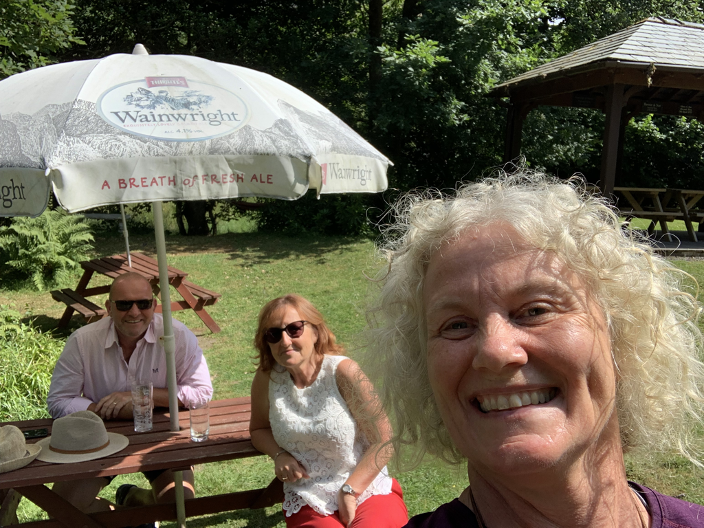 Stats
Miles walked: 8.5, plus 2.5 to get to dinner…., Ascent: 1673 feet Calories burned: 1500 Number of new blisters due to fancy new socks and extra blister plasters - 0 Number of new horse fly bites due to wearing long trousers instead of shorts - 0 Cockiness at sorting out both of those issues, probably too annoying to measure. Hearty post walk meal and local tipple: Roast chicken plus mammoth Yorkshire pudding with locally made Tirril Cumbrian Elderflower & Borrowdale honey gin with lemon and mint and Marlish tonic Video of the day is here: https://www.relive.cc/view/vdORwAxG9r6 BlistersI’ve trained hard for this walk. I’ve increased the mileage of my daily dog walks gradually, and in the months before setting off I’ve included long walks of 12 to 15 miles into my routine weekly. I’ve carried the pack with the right amount of weight, used the same boots and socks as I would be using for the real thing. And I’ve never had a blister. But yesterday I looked at my feet at the end of the day and had one full blown on my left foot and an incipient one on my right. So far Bill Bryson hasn’t talked about how annoying blisters are, and how your whole body starts to focus on a square inch of skin. I could tell him some facts if he wants them. I’m not sharing a photo…. I started walking into Borrowdale today. This is quintessential Lake District, with black and white flower decked houses adding subtly to the stunning landscape. Early on, the path played a similar trick on me as yesterday - disappearing entirely and leaving granite slabs in my way. At least this time I knew I wasn't lost, as there were metal chain link safety rails to grasp at to avoid slipping into the beck as I walked at 30 degrees to the slab. 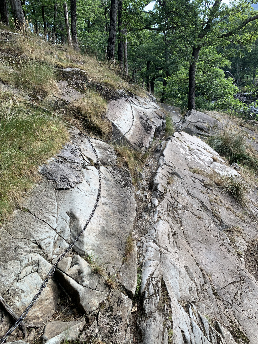 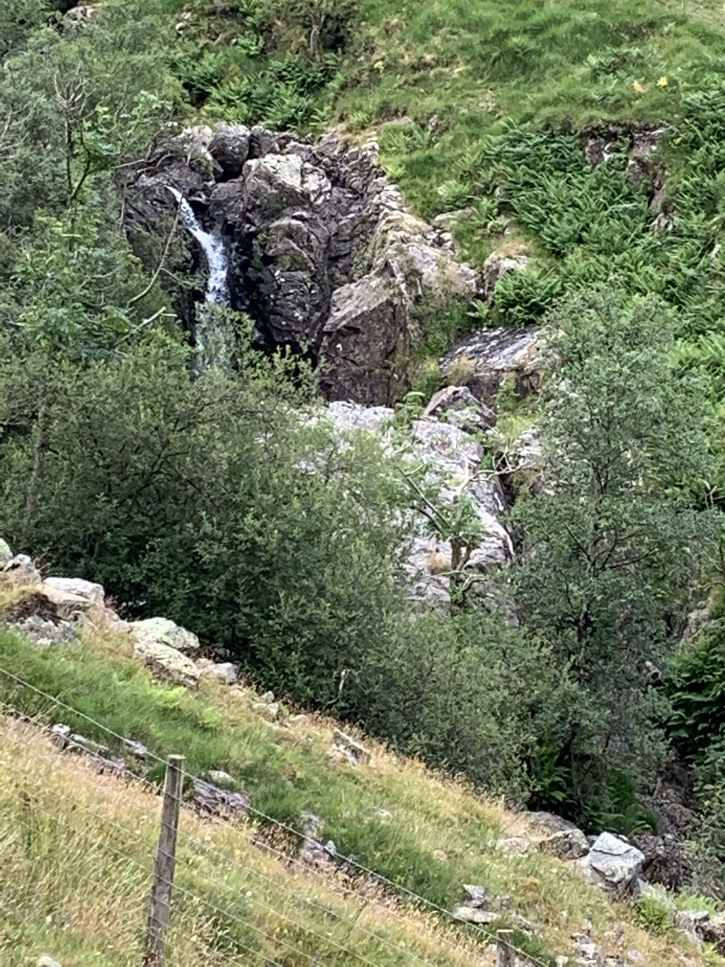 After a slog uphill, following the beck past the Galleny falls, taking every opportunity to stop to look at the expanding vista, (nothing to do with the hammering heart) I stopped at a verdant glacial bowl at the head of the valley before the last push to the edge. It was utterly still there, and the only sounds were the sheep calling each other over the sound of the beck bubbling up. Not too hot, but a bit of sunshine, and as I lay on the turf with the sun on my face I couldn’t feel my blisters. Blissful. And no one else here. Climbing up the Greenup Gill valley with Eagle Crag to my right, I heard what I thought was a sheep in distress. In fact it was a woman painstakingly walking uphill on a trajectory away from any footpath, groaning loudly with every step. Maybe she’s got blisters too. 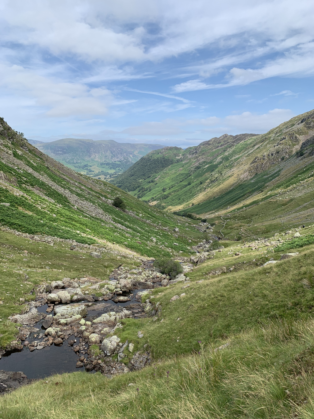 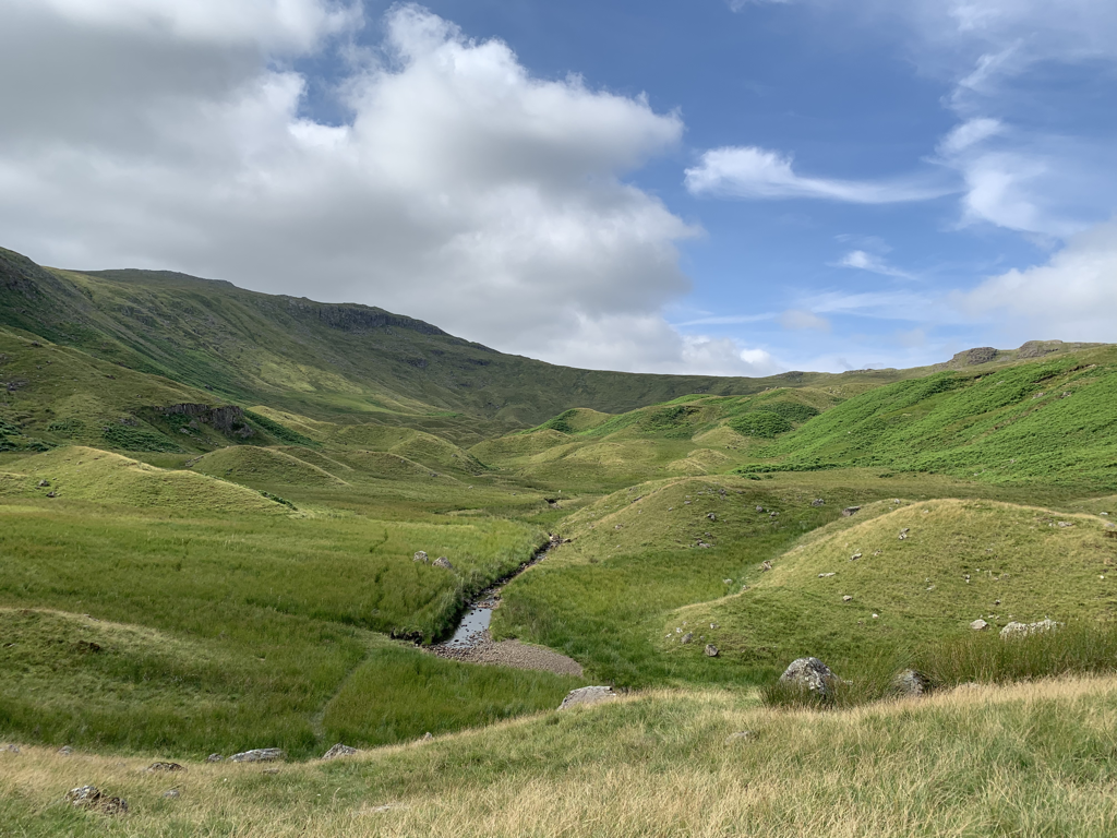 Climbing up the side of Lining crag, the path disappeared again. This time I had to scramble up boulders, leaning my pack forward so that it didn’t make me topple backwards. I tried not to think about what would happen if any toppling were to occur, especially after I saw the big dent in my thermos as it fell out of my rucksack and tumbled down the slope. A very different experience from the bouldering centre I enjoyed in Milton Keynes where there’s a nice cushioned floor at the bottom. 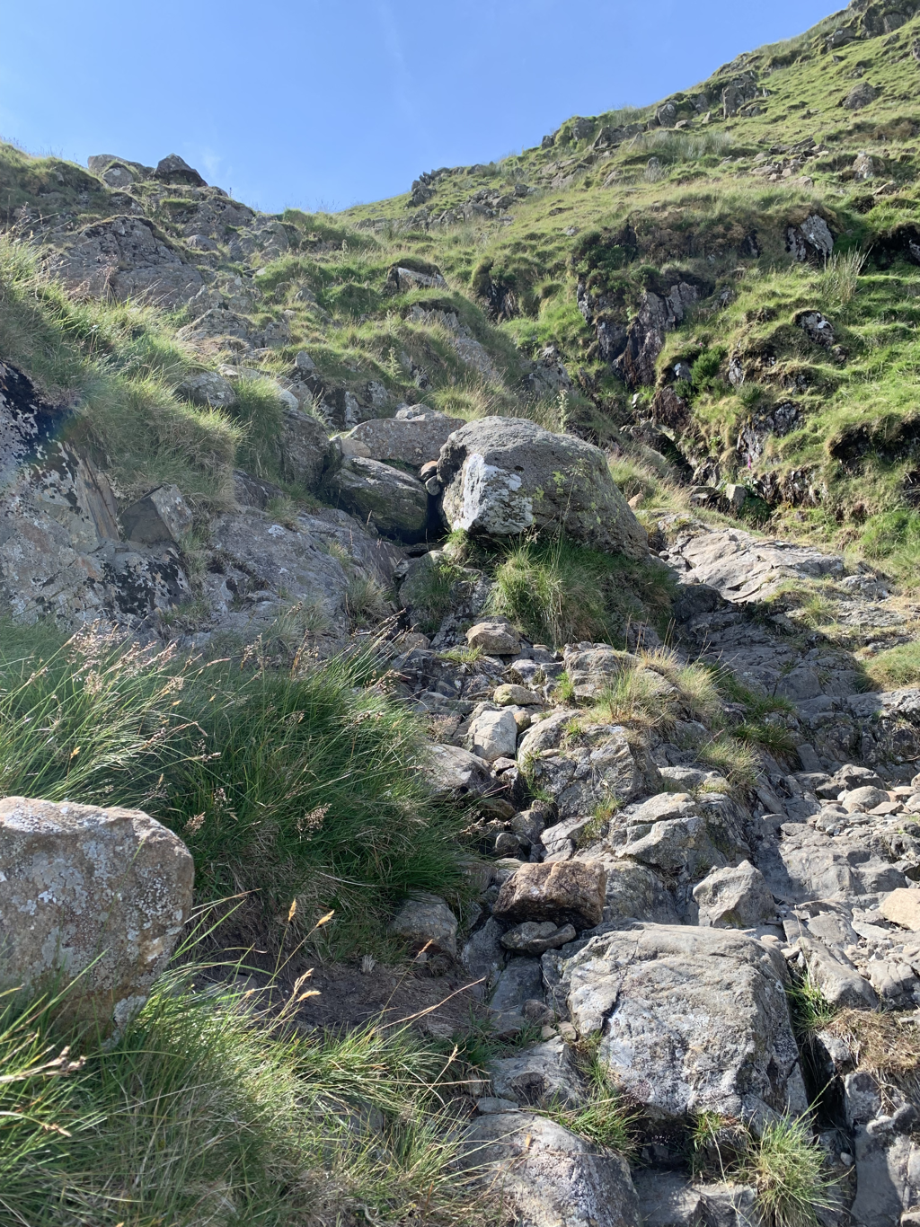 And then out onto Greenup Edge for my lunch, negotiating some very boggy ground to get there. It’s remarkable how waterlogged the land is, even though there’s been little rain here for a while. Having fallen flat into bog in training, I was happy to negotiate this without much more than wet ankles. 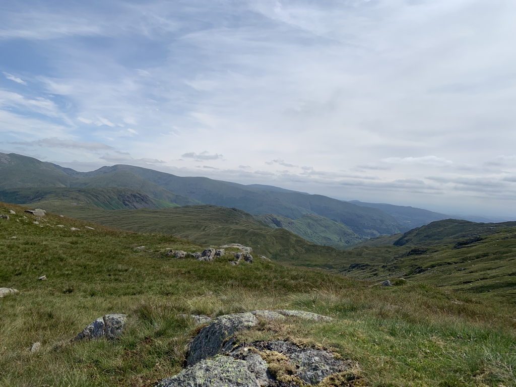 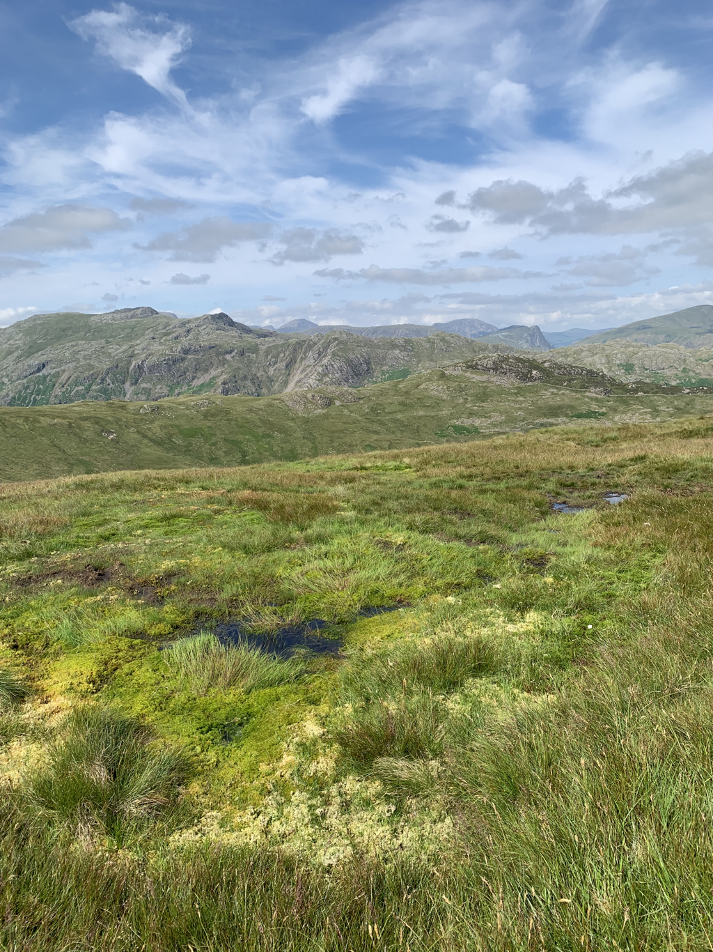 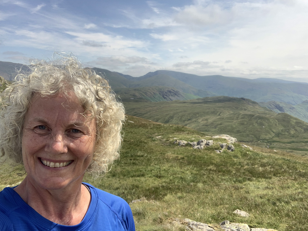 Looking to the west it was clear enough to see the sea and approximately where I’ve come from. Looks like I’ve walked a long way already. I sat for a good half an hour feeling so grateful for this experience. The voice of anxiety was giving a narrative about what might still be ahead, but just for this moment I was enjoying the quality of my excellent tuna sandwich, the fact that I’d got here under my own steam, and that this landscape was indeed ‘nature showing off’. 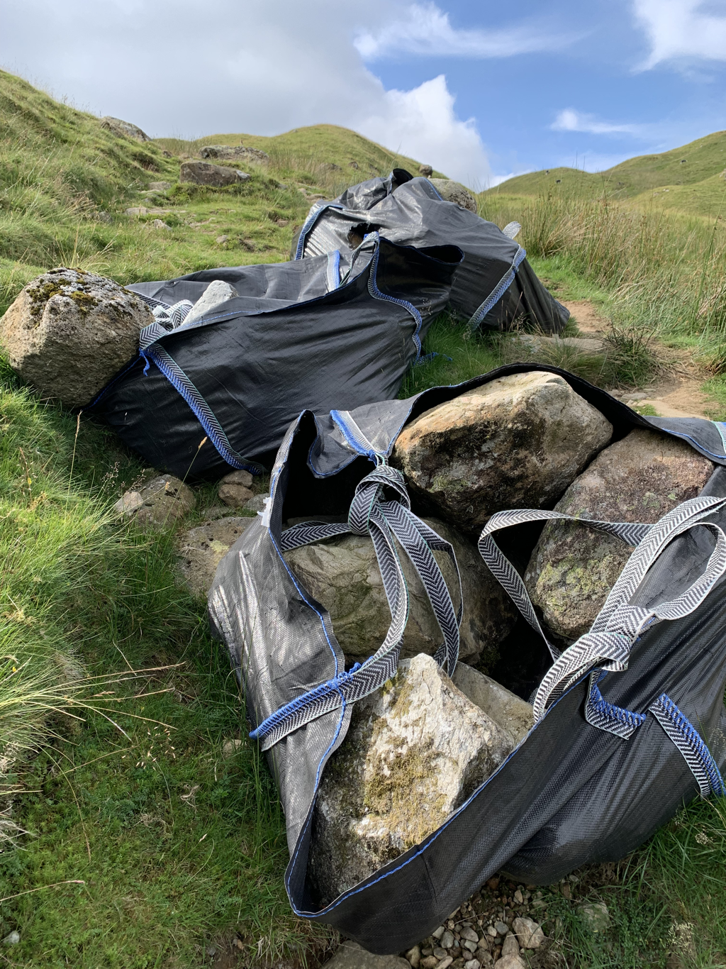 The descent was tedious - long and demanding without the glorious views on the first side of the ridge. At regular intervals on the path are what appear from a distance to be large bags of shopping. On closer examination, they’re massive plastic bags filled with boulders. The National Park rangers are constantly repairing the path, I can only presume that these bags have been helicoptered in. Bill kept me company again, giving me information about the brain and the senses. The takeaway for today is that the brain is constantly expecting and predicting what is to come, so what we think is reality is actually coming a fifth of a second later. Which blew my mind, a fifth of a second later than it actually did…. 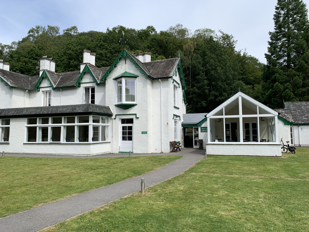 The Glenthorne is a Quaker hotel and conference centre. Such a calm, welcoming atmosphere, I felt at home here far more than any of the other places so far, and the moment of silence that was observed by everyone before eating this evening was lovely. It’s just on the edge of Grasmere, a Lake District tourist village with gift shops and tea rooms. But to go alongside the holiday paraphernalia it also has 4 different outdoor shops at which I bought more blister plasters, and socks that guarantee they will not cause blisters. Sadly they don’t guarantee they’ll fix blisters. Stats:
Miles walked - 10 (felt like more, certainly took ages!) Ascent - 1800 feet Calories burned - 1700 Excellent rum and raisin ice cream - 1 Hearty post walk meal and local beer - salmon fish cake, veggie tagine, pannacotta at the Glenthorne, Lakes lager at the pub in Grasmere Video of the day - https://www.relive.cc/view/vZqNYXpgn36 SoloI said goodbye to David feeling wobbly and anxious, after having spent a disturbed night on the floor to avoid knackering my already delicate back on the very soft bed. I’d thought that I’d be filled with excitement today, but mainly it was trepidation. We walked together to Ennerdale Water so that he could have a glimpse of a lake before he started the journey home. I was glad that the first solo leg of the day was going to be what I thought would be an easy gentle stroll along the water. 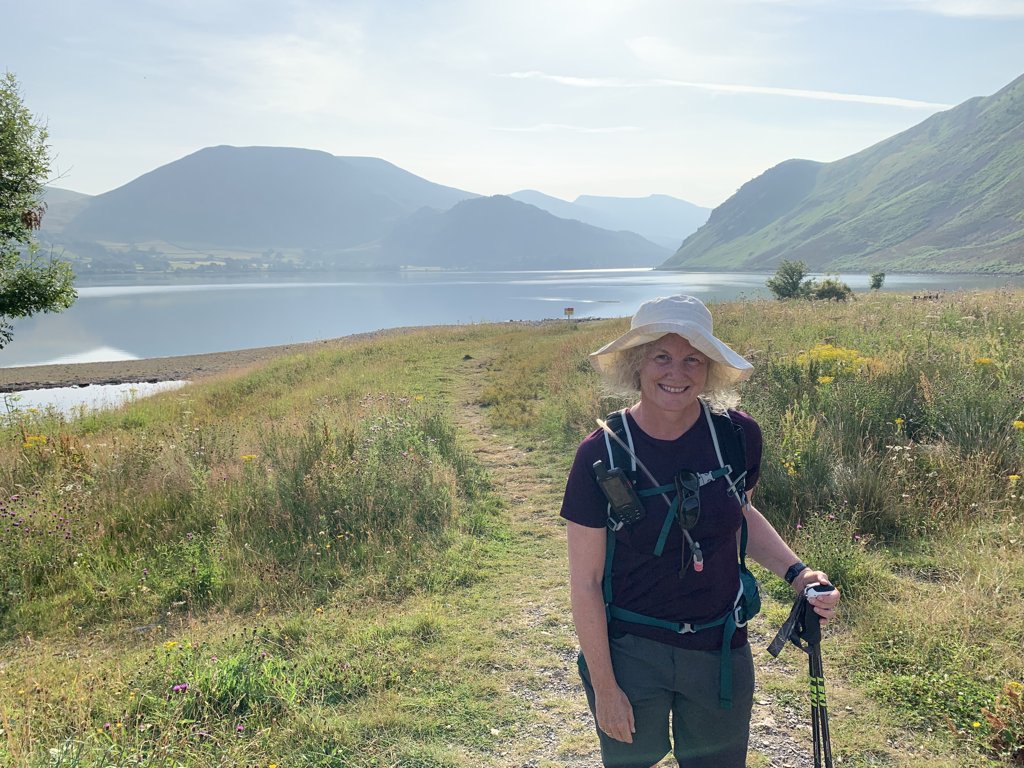 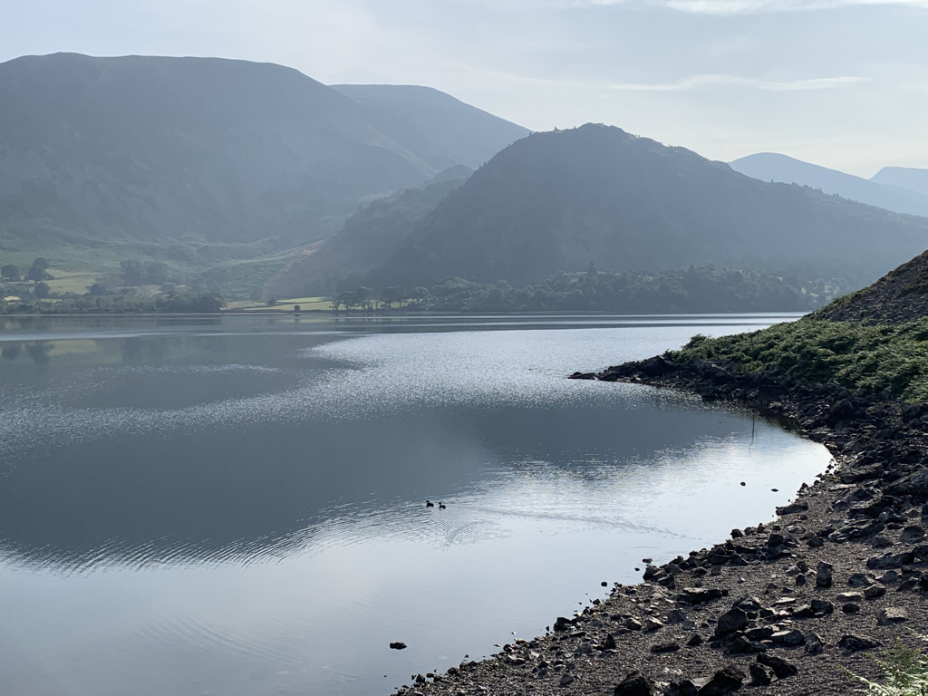 And so it seemed to begin with. Harder under foot than ideal, lots of boulders and scree, but beautiful and there was no one else there. But then unexpectedly the path veered steeply uphill, there was no option but to follow it. And then it disappeared, leaving instead a 15 foot granite drop. I heard myself say out loud ‘you can do this’ and I threw down my poles to the bottom, hoping I’d not hear them bouncing into the lake. I manoeuvred my start-of-the-day heavy pack and the past-the-middle-of-my-life heavy me down, looking for secure footholds and handholds all the way. I got to the bottom and was on a little ledge about 30 inaccessible feet up from the lake. Up to my right was what looked like a path, so there was another heart stopping climb up scree, and then I was back. As if nothing had happened, the path continued to meander, maybe it was checking I was really up to this. Later, looking back with heart still hammering and my legs still wobbly, I realised that the section I’d clambered down is the outcrop described as Robin Hood’s seat. A particularly appropriate place to be tested. 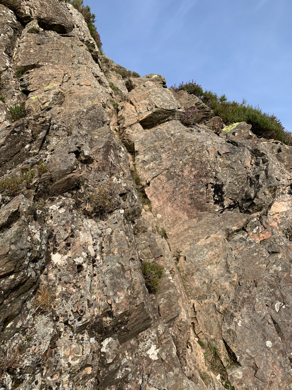 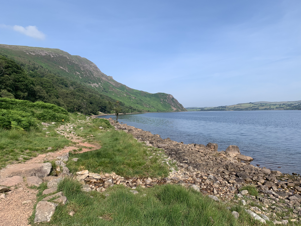 A tough slog up the north side of what was Ennerdale before it was dammed. Forestry plantation and felling and a dusty forestry track. No chance of getting lost, but also not much to lift the spirits, with piles of lumber and swathes of deforestation. For the first time I started to listen to an audio book to keep me going - Bill Bryson’s The Body. It felt appropriate, as I am so very aware of mine whilst trekking. He gave useful information about sweating and how long soldiers could walk in 28 degree heat without additional water before collapse - 48 miles it seems. They’re tougher than me. I’ve not seen one person walking the path west to east today. In the whole of the morning I saw two walkers going round Ennerdale, two cyclists - one a very confident dad speeding down the track creating plumes of dust, followed a distance behind by his much less confident teenage daughter, half on her bike, with one foot down on the ground most of the time looking utterly miserable. I wanted to give her a hug. 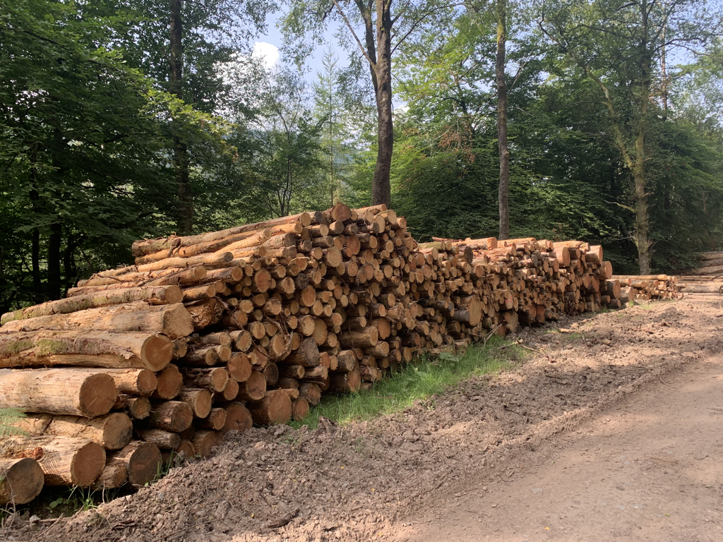 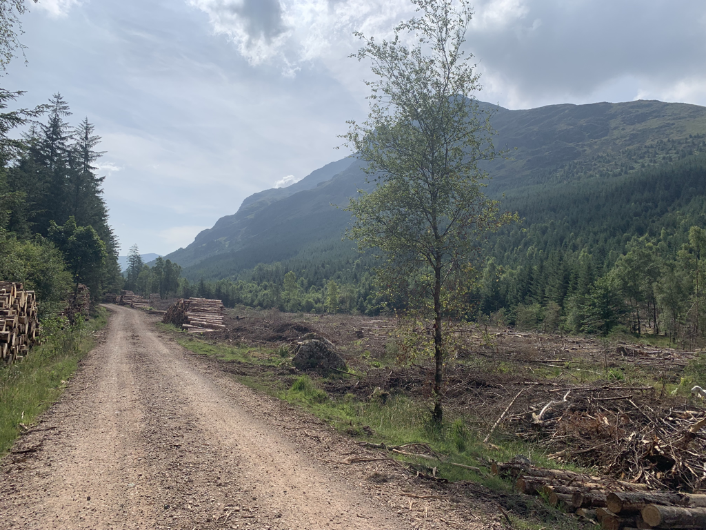 Stopped for lunch at Black Sail YHA - it was sadly closed for a private hire (though no one here), but had a welcome tree for shade. Whilst having my lunch I chatted with the manager who impressively made her way up the footpath in a 4x4. She told me of her plans to do the Camino last April, at the time I would have been doing the End to End. We agreed our audacity to make plans means we must therefore be jointly responsible for the pandemic… 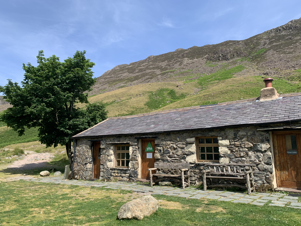 Then the ascent of Brandreth to get over towards Honister. Trying to push novelty jumpers out of my mind, I soon discovered I’d taken the very path indicated by my excellent Cicerone guidebook that I should avoid. If only I’d read it earlier. But a combination of careful looking at the map, and some scrambling over scree and across becks put me eventually on the right track. Built almost like a series of steps up the slope, and following Loft Beck, it was eventually a clear but very demanding ascent. The view at the top was worth it though. The path is named Moses Trod, and is an old slate road which is possibly named after a quarryman at Honister (the other side of the path) who was an illicit whisky distiller who had his still concealed among the crags. I saw no whisky, and had run out of water by the summit. I’d packed 2litres instead of 2.5, thinking that as the day was shorter than yesterday I wouldn’t need it, and was minimising weight in the pack. That was a mistake - although the route today was shorter it was much harder. I’ll take the maximum tomorrow. 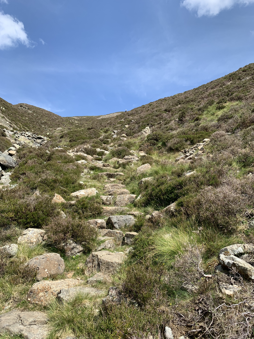 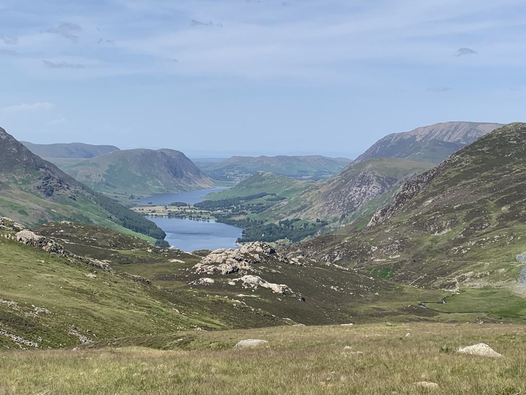 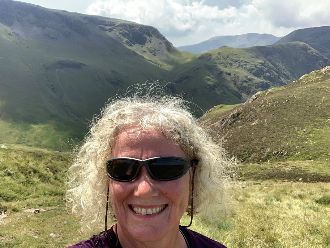 The walk down was straightforward but thirsty. I passed the Honister Slate mine and took the footpath on the fells instead of the road winding down to Seatoller. Never has a pint of lime and soda been more gratefully received.  Glaramara used to be a youth hostel. It’s much more upmarket now, and packed with people (possibly not exactly youth ) who’ve been walking and bagging Wainwrights today, or driving round and seeing the sights. The busiest place I’ve been to since starting the trip - I am quite enjoying being the solo traveller observing from the outside. It’s a new experience for me, and one that is part of this challenge. I love my family and friends very much, and it will be one of the hardest things about the trip being without them. But it’s also an opportunity to see who I am on my own. Stats:
Miles walked: 14.5 Ascent: 1800 ft Calories burned: 2300 Annoying blister having not had any in training: 1 Hearty post walk dinner and local beer: Fancy 3 course meal with melon starter, salmon and ice cream with Lowerswater Gold HeatWe set off at 6.45, and it was already very warm. This first leg is one of the longest, and it starts with a period walking north west from St Bees. This feels counter intuitive for a west to east walk, but it grounded us thoroughly at the coast before venturing inland. We did the coast to coast rituals - I stood in the sea to get my boots wet, took a pebble that will eventually be deposited at Robin Hoods Bay and got a photo in my Buckinghamshire Mind t shirt, to help with fundraising. 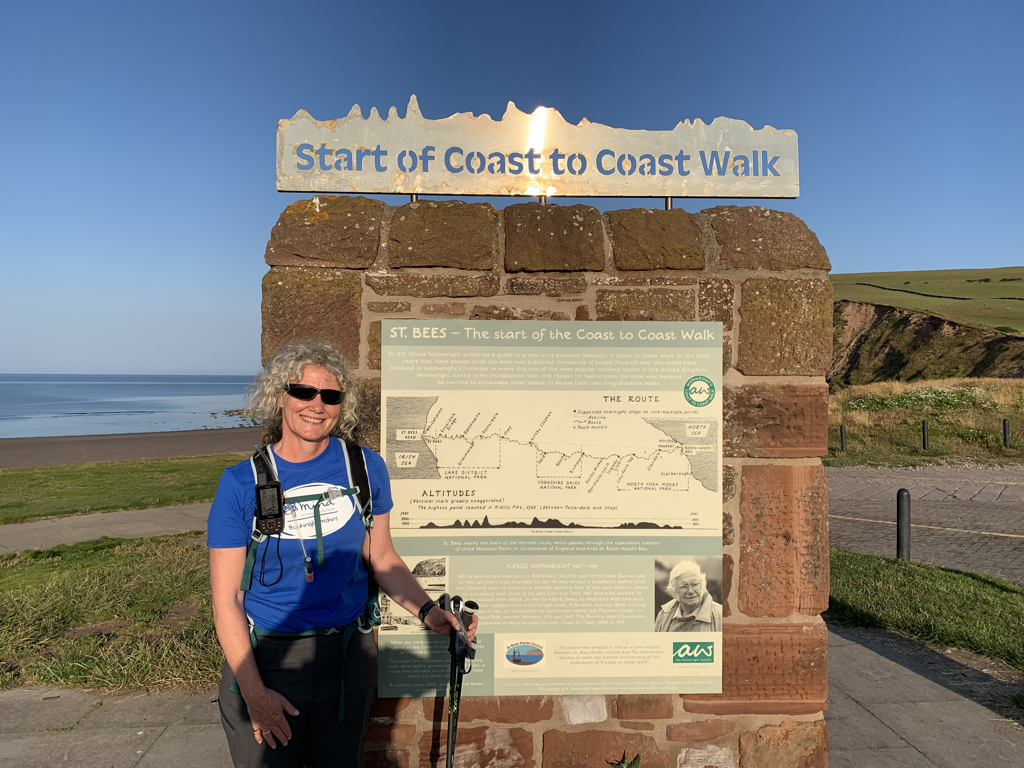 The coastal path section of this first day was stunning. Blue skies and utterly still sea. The only disturbance was the flock of seagulls following a fishing boat, and then later the black guillemots and other seabirds nesting at St Bees Head. Apart from a couple of dog walkers, we were alone.  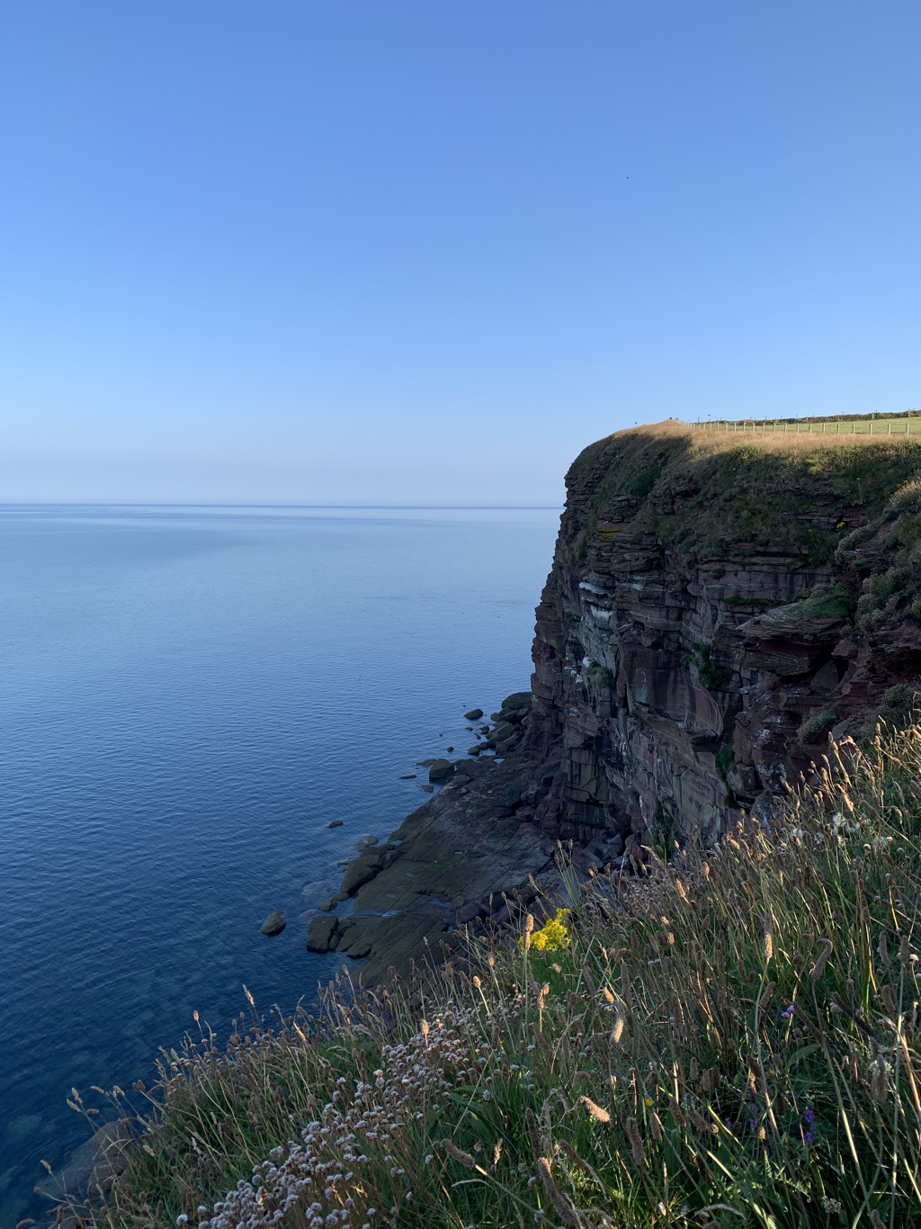 It takes 4 or 5 miles until the path turns inland and east, and then it felt like the journey had properly started. The sun was ahead of us, the temperature rising. After a couple of hours we stopped in the shade at Sandwith (Sannith), feeling overheated and a bit shaky. I carry a lot of water in my pack - a 2.5 litre hydration system and I also for this leg had an extra water bottle and a thermos of tea. By the end of the journey I’d drunk it all. I wonder whether there is a perfect formula for the amount to carry for hydration as opposed to the dehydration that comes with the extra weight it brings. Someone has to consider these things…. Although not a National Trail, the route was brilliantly marked today, sometimes officially, sometimes more ad hoc. Always useful and appreciated.   Through Moor Row and Cleator, quiet Lakeland villages, and the last habitation before our first fell. Given the high profile of the walk, and the glorious day, it was interesting that during the whole journey we only met two other people walking the C2C. Both women of my sort of age, both travelling solo. And both camping. I love the romantic notion of that, but know that in reality I’d prefer to have a shower and a bed. And whereas before I might have decided that it wasn’t a tough enough challenge to stay in a B and B, now I’m quite happy to acknowledge that’s what I’d prefer. We started the climb up Dent Fell, rising through the forest of Black How plantation. Some moments of short lived shade, and then out on the face of the fell. This was a really demanding section. Although the views were amazing, so was the level of my heart rate. But we took it easy, and another lesson from today was that actually sitting to take a rest now and again is fine. In fact more than fine, as it gives more time to look at the scenery. 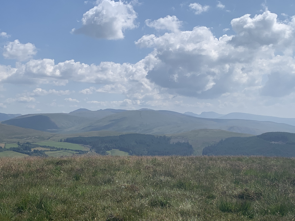  Being out on these fells again, forgetting Covid, looking at the wrinkles and folds of the landscape on the most beautiful day felt like the greatest privilege. However hot, it was glorious. A hairy descent and then another joy, walking through Nannycatch valley. Lush green, vibrant wildflowers and the beck cris crossing the path.   And then it was almost done - a gentle descent down into Ennerdale Bridge to find the Shepherds Arms and more hydration. I’m really pleased with how we’ve coped with such difficult conditions, and it’s giving me the confidence to look forward to the next days solo. . 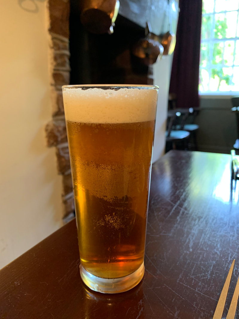 Stats:
Miles walked - 16 Ascent - 2362 feet Calories burned - 2700 Number of times I got us lost - 0 Number of cows sitting on the actual trail but yet I walked bravely past them - 4 Hearty post walk meal and local beer - sausage and mash with Mowdy pale ale Video of the day is here: https://www.relive.cc/view/vWqBrEG19Yq We made the journey North today, with a growing sense of anticipation and excitement. Stopping at the excellent Gladstone Pottery museum, partly to learn about the appalling conditions that were suffered by the people of Stoke in the making of pottery, and to admire the skill of the artisans, but also because the joy of the Great Pottery Throwdown helped us through lockdown 3. 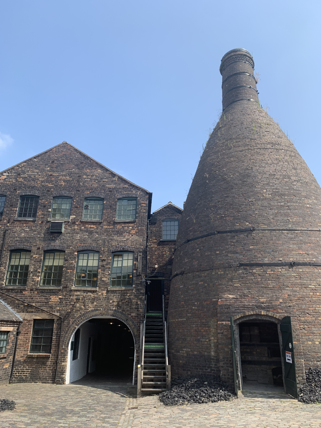 And then on to St Bees, the start of the Wainwright Coast to Coast path. Dominated by a large school, with an incongruous railway station in the middle, it is a gentle place where we had a warm welcome at Stonehouse Farm. 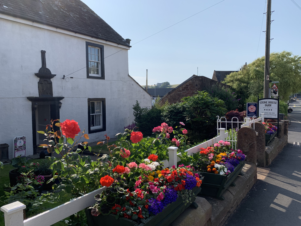 Just down the road is Whitehaven. Suffering from the high street decline of many coastal towns, it also has a flourishing marina, and was glowing in the evening sunshine. I’m noticing the gradual easing of mask wearing, and also noticing the concern it causes me - everything is referring back to avoiding the virus so that I can complete the walk. 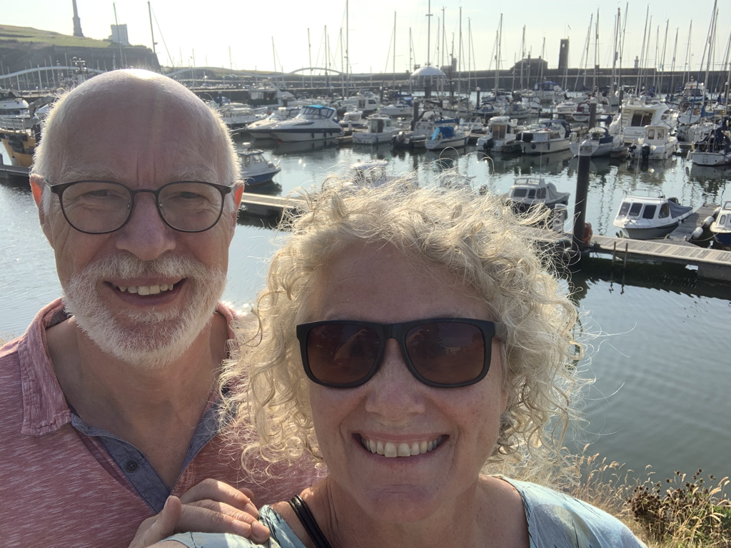 The forecast for tomorrow is very hot again. So it will be an early start to get ahead of the weather - David keeping me company on my first day.
I love planning, and hate packing. I never travel light, and find it physically uncomfortable to leave out that extra t shirt or added jumper. But a trip like this requires more precision, and even though I am only carrying a day bag for this shorter trek, it will become onerous if there’s too much weight. I had planned to carry an 11 litre day bag, but fortunately realised in time that I might not have room for my lunch…. So now my day bag is 20 litres, and it’s still pretty full. The rest of my luggage is going to be taken by Brigantes luggage transportation, which obviously means I can be a bit less strict about what can be brought than when I’ll have to carry the whole lot. My party game when preparing in spring 2020 was to see what someone’s luxury item would be, what would make the cut into their rucksack, beating in mind it would have to be carried for four months. It’s an insight into priorities. Another hot day today, so no training. And another wobble of doubt this afternoon. It’s ‘freedom day’ today. Instead of embracing the end of restrictions, I am ducking away from anyone in public and keeping loved ones at a distance to minimise risk. Every day I don’t catch the virus is another day I’ll be able to walk across the country.  Three days before I set off, we have the hottest day of the year, creating crushing lethargy. The habitual and increasingly noisy voice of anxiety pointed out that all I had to do today was walk to the fridge now and again, if the weather persists then how am I going to manage a 16 day trek?
And Covid lurks in every corner. Numbers soaring, everyone knows someone who is ill, even if double jabbed. I am increasingly keeping myself away from others, fearful that my chance to walk might be snatched away from me at the last minute. Before even starting, this walk has already been a test of mental resilience. I can’t wait to get up north and get started. |
ArchivesCategories |
 RSS Feed